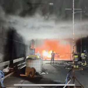
Matching underground design carried out by numerical methods to ground and structure performance data, thus checking to see whether the design is perfoming in practice to design requirement, should ensure a successful outcome. There are many stages in this process, including construction processes that could have greater inherent risk than achieving the final structure. Monitoring ground reactions, any neighbouring structures that may be affected, and the performance of any temporary structures should reduce overall risk.
Sensor design
The vibrating wire design of sensor for monitoring various values has served the industry well over many years but, although it will continue to do so in many cases, alternatives are now available.
One of the major advances has been the development of small electrolevels. These comprise of a level vial of conducting fluid fitted with three or more electrodes. A tilting action alters the amount of conducting fluid between electrodes, thus giving the basis of measurements due to changes in electrical resistance. Their advantages include simplicity, robustness, reliability, stability and their ability to be installed in many situations due to small size. Correct installation, calibration and interpretation of data should also result in high accuracy.
A typical electrolevel tiltmeter (EL) is available from Interfels, now part of itmsoil. This particular model is used mainly for the monitoring of the inclination of structures, particular high ones such as towers and bridges, as may be affected by ground movements due to underground construction. It includes one of two electrolytic tiltsensors to cover ranges up to three or ten degrees. There are no mechanical or moving parts, making it very robust and reliable. Current readings are compared to the initial reading.
Other designs making an appearance include fibre-optic distributed sensors, especially for high accuracy strain measurement and other spatial values.
Cost trends
The reduced costs, in real terms, of geotechnical sensors has enabled more to be installed, given better coverage of a structure or strata of interest, further increasing the reliability of an overall installation as more redundancy can be tolerated. There is also the new availability of wireless transmission of signals in many situations (although more limited underground), allowing more efficient monitoring processes. Geotechnical monitoring cost reduction relative to overall project costs is particularly fortunate for urban tunneling as it allows a greater proportion of the overall budget to be devoted to risk reduction.
Tunnel deformation
One application of electrolevels in tunnelling, introduced about 17 years ago, is in the detection of deformation of tunnel linings that may be affected by adjacent excavations. It was introduced to the construction of the Jubilee Line Extension in London, starting with the London Bridge site, and consists of the use of electrolevels mounted on interconnected beams. Developers of the system say that it is accurate enough to detect the small cylindrical displacements due to tidal effects, while being robust enough against the effects of temperature, vibration and dust.
Computerised logging has made it easier to utilise electrolevels for active warning systems as well as passive recording of data. This includes the monitoring of the effects of processes such as compensation grouting whereby the process can be adjusted according to its effects, whether desirable or excessive.
An alternative approach to the deformation of segmental linings has been developed by VMT as the Ring Convergence Management System (RCMS). It employs a series of inclinometers for data collection on relative movements of tunnel lining segments. The sensors are mounted round the lining ring intrados for continuous monitoring. The data can be integrated into the VMT Controlled Boring Process via the computer of the TBM guidance system.
Data handling
The collection and treatment of data is another area in which major advances have led to increased reliability, as well as expanding the possibilities for better understanding of project performance through computerised analysis. Automatic data collection has been available for many years but its recovery, publication and the identification of problem areas could be laborious. With computer analysis, the first advantage was the automatic identification of problem areas (or failed individual sensors) according to pre-set warning levels or alarms. These warnings can then then transmitted as an SMS message to the mobile phones of responsible engineers, emailed to a central control office, or otherwise log the emergency situation according to agreed project procedures for action.
Software packages can now analyse data to provide visual presentations that often make it easier to indentify problem areas and, using colour coding, to indicate the extent of major changes. It is claimed, in many cases, that the use of these and related techniques, have enabled major projects to be built more safely and efficiently, at lower cost.
Geotechnical instrumentation installations come with a wide range of site situations, sizes and purposes, and this helps determine the type of data logging required. ‘Boxed’ data loggers can be installed on or near the site and the instrumentation, with facilities for downloading their information. Traditionally the data transfer method has been hardwired or by plug-in connections, but now wireless transfer is available if the location makes it possible.Whilst underground transfer by this method, as in other locations with radio interference, can be problematical, the datalogger could be hardwired from the instruments to a more suitable location.
Interfels of Germany (itmsoil group) has used data loggers produced by Campbell Scientific of the US as well as designing its own. The basic Interfels models are housed on steel or reinforced (grp) IP65 enclosures and come with additional modules including power supply (12V or mains) and communications kits. Solar cells or wind generators as well as the mains can provide power. There is a switched mode AC ‘bus’ system avalable for where locators are located away from mains power. Communications can include GSM or GPRS modems to send warning or alarm text messages. The loggers are flexible in use for configuration of large numbers of similar or different sensor types, and each datalogger is tested with a program specifically for the sensor types being used on the project and configured to customer requirements.
Geokon’s datalogger interrogation system, for which new software is now available, is designed for Model 8002 (LC- 2) Series dataloggers including 2-, 4- and 16-channel versions. Called LogView, the new software simplifies the task of configuration, communication, monitoring, data collection and data reduction. To do this the computer display uses an explorer ‘tree’ in the left-hand pane and ‘views’ on the right-hand side. The system includes screens for configuration, connection, measurement and data collection, plus a real-time, text-based monitor, a graphical monitor and terminal emulator.
Dr Hai-Tien Yu, chief technology officer of it msoil, pointed out to T&TI that the much-quoted process of ‘real-time data handling’ is not really new. “We’ve been doing it for 20 years,’ he says, “although technology has advanced quite a bit in that time. In the 1990s the data logger and the IBM PC were combined to form a powerful tool in a Trafalgar House R&D venture. As part of the Cairo Wastewater Project, chemical grouting against water inflow was controlled with the aid of real-time monitoring so that grout pressure and volume could be maintained at the right values to avoid blockages while completing the work. Volumes injected and together values were recorded and could be reported for three grouting machines each with four lines of values.”
Risk management
VMT’s Nod Clarke-Hackston states that the real challenge for using geotechnical instrumentation data is to convert notable values to action within the tunneling operation, particularly between any surface movements and underground excavation, annular grouting, etc. As previous collapses have shown, it is a matter of ‘cause and effect’ unless necessary and timely actions are taken according to the data collected. “You need an experienced person to be available to assess the data and to do something, whether it’s to stop excavation, increase support or other action to prevent deterioration. This is so whatever the time. Significant geotechnical data received on 16:00 on a Friday cannot be resolved by a meeting on Monday! You need 24-hour a day coverage on behalf of a continuity team with the authority to respond.”
Having introduced its own tunnel management system, the CBP (Controlled Boring Process) information system, VMT has entered into a joint venture with Strabag group contractor Zublin to form ITC Engineering. The CBP is a system for documentation, storage and monitoring of all operational parameters, including geotechnical data, with the function of evaluation and analysis for mechanised tunnelling. This enables data to be supplied to experts in as near ‘real-time’ as possible to enable decisions to be made for safe process control. ITC Engineering is further developing the concept using the process data management system IRIS (Integrated Risk and Information System). The development is described in a new paper by Schneid and Franzius to be published in English in the future issue of T&TI.
As pat of the European Union-funded Tunconstruct programme, Geodata of Austria, together with Geocisa of Spain and GIScience, also of Austria, has developed the Underground Construction Information Systems (UCIS) incorporating Godata’s Kronos tunnel information system relating surface monitoring and TBM performance.
Project performance
The successful outcome of underground construction projects is increasingly related to geotechnical performance both for their own sake and for minimal disturbrance of surrounding structures.
This is particularly so in the case of urban tunnel projects, such as in the boom in metro construction.
International geotechnical and construction monitoring specialist contractor Soldata, part of the Soletanche Bachy group, has been engaged on many underground construction projects including metro running tunnels and stations. SolData is also a distributor for Gage Technique instruments and sensors. For the Budapest Metro, Line 4, project SolData has been carrying out real-time monitoring of buildings and ground deformation, as well as noise and vibration. The equipment employed included 30 Cyclops/Centaur robotic total station systems, 50 extensometers, 20 inclinometers and 120 electrolevels. The results from this automatic equipment were complemented by traditional leveling together with surveyors Hungoeod.
The data is transmitted wirelessly to a central database from which it can be visualised in real time using SolData’s monitoring software, Geoscope Web. The results can be accessed remotely via the Internet for evaluation and interpretation. An automatic alarm system is included within which, in the event of predefined threshold limits being exceeded, an automatic SMS message or email is sent to the appropriate managers and engineers.
Crossrail
Another important urban rail project Crossrail across London. In view of the problems occurring in some sections of the last major urban rail project in the centre of London, the Jubilee Line Extension, there is increased interest in the monitoring of construction along this route is heightened. The itmsoil group has been awarded the Crossrail C701 instrumentation and monitoring contract. This includes the supply and installation of automated monitoring instrumentation and monitoring of a range of existing tunnels, buildings and infrastructure including that of London Underground, the Docklands Light Railway, and Network Rail. C701 is claimed to be the largest single contract for geotechnical instrumentation and monitoring ever undertaken in the UK. itmsoil has previously worked on the Victoria Station Upgrade, the Channel Tunnel Rail Link and Jubilee Line Extension in London.
itmsoil will be providing, maintaining and managing a central database to collect data from all site instruments and other locations along the contract route. Termed the Underground Construction Information Management Systems (UCIMS), it is designed to collate, manage and present information on construction progress together with date from the monitoring instrumentation. This will be accessible by all contractors and supervisory teams.
Hai-Tien Yu has had project geotechnical monitoring experience in the US since 1998 including in the reconstruction of the subway in the New York World Trade Center after the 9/11 collapse, the Second Avenue Subway, and the Eastside Access tunnelling also in New York.
At the World Trade Center the original subway (metro) tunnel for the No. 1 Line was replaced with a reinforced concrete box structure in 2002. Further property development on adjacent sites rather than on Ground Zero itself (to be left as a memorial) called for excavations under the subway box to create other structures. The box was supported by 450 minipiles drilled into the bedrock, and a beam placed over them to distribute the load of the box, with load-transfer beams and rods.
All this work required precise monitoring of the box structure and surrounds to ensure no disturbance of the working railway and the stability of the whole structure.
The World Trade Center work demonstrates the advantages of modern geotechnical instrumentation. Originally adjacent instrumentation options were limited to horizontal inclinometers on roofs with manual reading. There were also 70-80 electrolevels at both ends of the ‘box’ where it was difficult to take manual readings reports Yu. “Over a length of 300-400ft (90- 120m) it took a whole day to take readings, and the results were not very good.”
Later an additional 270 electrolevel beam instruments were installed on both sides of the tunnels with remote data collection. “These were in place from since 2008, and I think they’re still running now. Manual readings were totally scrapped.”
On Crossrail Dr Yu says it is too early to comment on the actual installation of geotechnical instrumentation under itmsoil’s contract, but the basic system will include itmsoil’s Underground Construction Information Management System (UCIMS) that was developed by a team led by Dr Yu. He commented to T&TI however that available computer power has increased more and more which, together with the development of remote-reading sensors, allows, in technical terms, more to be installed giving a better ‘picture’ of the project. C701 will be managed from itmsoil’s new Major Project Office in Holborn, opended in September last year to house over 20 staff.
Each major technical development has been associated with a major project. For example the JLE project was followed by development of the Bassett Convergence System using prototype installations in active metro running tunnels around London Bridge for the JLE Project. Later, with the construction of the Portcullis House parliamentary office bock over the new Westminster Station, the structural load had to be transferred to the tunnel level including the interim use of hydraulic jacks.
This process necessitated the use of hundreds of sensors and the project was the first to use ‘Windows’-based data presentation to more easily handle the large amount of resultant data.
Web-based data
With the use of computerisation being widespread it requires only the use of common compatible software to allow all relevant parties in the project to share data and its analysis. It has become more efficient to used web-based data management, especially for widespread access to and presentation of geotechnical data, allowing remote monitoring of projects. “The biggest change was in 2004,” says Yu, “when systems could change from ‘Windows’ to a web-based systems for better sharing of data.”
One such system is Argus, an itmsoil product developed by Interfels that was acquired by itmsoil in 2007. This is totally web-based software developed for the open-source LAMP (i.e. Linux, Apache, MySQL and PHP) computer system. There is no need for special software on users’ own computers or licence payable; only standard browsers. Argus can be operated across the whole Internet or just in a local network.It has been used on Crossrail already and several New York projects.
Yu says that Argus is under ‘constant development to satisfy new user requirements including Geographical Information Systems (GIS) functionalities, construction progress information management and is compliant to the AGS (Association of Geotechnical and Geoenvironmental Specialists) data format. In addition standard functions Argus specialities include:
• A purchase or rent option (the latter based on itmsoil servers).
• Multiple-language support.
• User-definable formulae with references to any sensor on the project.
Ability to present in two engineering units in one plot (dual Y-axis).
• Alarm if no data has been received in a set time.
• ‘Virtual sensors’ to allow calculation of values such as averages and data corrections.
• Automatic issue and distribution of reports as pdfs.
• Back-ups to users’ own PC.
• Additional project information input.
The latest version includes GIS functions, facilities for TBM data input, multimedia records including videos and photographs, and permission group management.
Display image of sensor points in itmsoil’s Argus software with integrated GIS Another GIS view from Argus at a smaller scale to show the tunnels’ routes Typical installaton of VMT’s Ring Convergence Measurement System (RCMS) using inclinometers to check on pre-cast segment lining movement