The North Downs Tunnel forms part of Section 1 of the Channel Tunnel Rail Link (CTRL, route shown in Figure 1), to be opened later this year, and is the only CTRL tunnel constructed by Eurolink using the principals of NATM. The tunnel lies to the south of Chatham with it’s north-west portal (London Portal) situated at the head of the Nashenden Valley and it’s south-eastern portal (Country Portal) located as the tunnel emerges from beneath the escarpment face of Bluebell Hill. At 3.2km in length and an excavated cross section of up to 174m² (13m diameter), it is also one of the largest rail tunnels to be constructed in Europe. The tunnel traverses through a varied sequence of chalk beds at a depth of up to 100m below the ground surface. Constructed five months ahead of programme and substantially under target cost, the background to its design and construction is therefore of considerable interest with much of its success being attributed to the technical innovation, value engineering and integrated observational approach adopted throughout its construction(1-5). A summary of some of the more important aspects is outlined below.
Geology and nature of the chalk
The geology along the tunnel, based on observations made in the tunnel and from borehole evidence (Figure 2), is as follows: Moving south from the London Portal, the tunnel encounters progressively older strata, Lewes Chalk (750m) gives way to New Pit Chalk (900m), which is in turn replaced by predominantly Holywell Chalk (1,543m); The Lower Chalk enters the invert close to Lower Warren Road, sited uphill of the Country Portal.
The tunnel generally lies well above the main water table in the chalk except where the groundwater catchment divides, under the main body of Bluebell Hill, where the groundwater level rises to within 3m-5m of the invert; a pressure relief system was installed over this 200m length.
Dissolution of the chalk was commonly observed along the length of the drive through the Lewes Chalk, in particular associated with the major flint horizons. A 20m deep solution feature, up to 10m wide at surface and extending down to tunnel axis level, was found to exist at the London Portal. A pipe arch of 115mm diameter, 15m long, Boodex micropiles were installed at 600mm centres around the profile of the tunnel opening prior to excavation. This solution also extended below the foundations of the canopy structure and had to be dug out to a depth of over 1m and filled with concrete.
Similar solution features were also encountered in the area of the Buckmore Park Go-Kart Track and adjacent the NNW-SSE aligned fault further south, where depth of ground cover is over 40m. The features were generally infilled with clay-with-flints (usually confined to areas where depth of cover was less than 25m) or remnants of the Thanet Sands. Small karstic voids, collapse structures and sand pockets associated with dissolution of the chalk due to past groundwater movement were also observed, adjacent to marl/faults within the New Pit and Holywell Chalk, even at considerable depth.
Tunnel design
One of the main features identified at an early stage was the varying topography and geology existing along the tunnel route. Therefore for the purpose of tunnel design it was appropriate to subdivide the tunnel into eight principal design zones (Figure 2), ranging in length from 250m to 600m, based on the dominant geology and overburden pressure. Several of these zones were further subdivided locally where special design considerations arose e.g. tunnel crossing beneath Buckmore Park Go-Kart Track where the ground cover above the tunnel was especially low.
The geotechnical parameters adopted for the design at tender stage were based on the best information available at the time. It was realised, however, that many of the design parameters adopted could be established with a greater degree of certainty during tunnel construction by carrying out further tests and by using an observational approach. The design parameters that required further clarification due to their considerable sensitivity in the design process were identified as; the in-situ stress coefficient Ko, the coefficient of creep f and the mass modulus of the chalk.
To provide additional information on the in-situ stress state, hydrofracture tests were performed in three 100m-120m deep boreholes RC9597, RC9598 and RC9599A, located on Bluebell Hill. These tests were carried out by Mesy using a wireline packer system. Hydrofracture testing involves injecting fluid, in this case water, into sealed-off borehole intervals, so as to induce and propagate a hydraulic fracture in the rock mass. Knowledge of the pressure data during hydraulic fracturing and the orientation of the induced fracture derived by impression packers subsequently lowered down the borehole, enables one to determine the stress regime in the rock mass.
The results obtained from the hydrofracture tests indicated that the characteristic minimum in-situ stress coefficient was in the order of 0.8, and this was orientated favourably (i.e. between NE-SW to E-W) and almost perpendicular to the tunnel alignment. The range of the in-situ stress coefficient for tunnel design was also satisfactorily determined to lie between 0.6 to 1.0, with adequate statistical justification to define these limits as upper and lower bound worst credible values. The design sensitivity envelope for the in-situ stress coefficient was therefore redefined. The on-site determination of the prevailing in-situ stress condition and the corresponding reduction in load factors for the range of stresses likely to be encountered, was a significant factor in developing a more economic tunnel lining configuration.
Upon completion of the tests, deep extensometers were installed in the three boreholes directly over the tunnel centreline, while additional extensometers were also installed immediately uphill of both the London and Country Portals and at Buckmore Park Go-Kart Track and close to Stable Cottage. All extensometers were monitored on a regular basis throughout tunnel construction, so as to allow backanalysis of the short-term movements to be carried out and the likely long-term creep movements to be determined.
The additional high quality chalk samples obtained from the hydrofracture test boreholes allowed further determination of the stiffness and creep properties of the chalk to be obtained in the laboratory. Both triaxial and uniaxial creep load tests were carried out with loads equivalent to 50%, 70% and 85% of the UCS being maintained for three months (triaxial tests) and up to one year (uniaxial tests).
Indications would suggest that creep of the chalk occurs even at the 50% strength level becoming more noticeable for the 70% and 85% levels. A coefficient of creep f between 0.2-1.5 was indicated from the tests, with higher values being recorded at higher maintained deviatoric stress levels, which is to be expected. The indications are that creep is due to collapse of the chalk pore structure. Results obtained in the field, however, from monitoring the deep extensometers would suggest that creep of the chalk mass is negligible.
The additional testing above, together with the observations made in the tunnel and results obtained from backanalysis, resulted in a drastic reduction in design load requirements of the secondary lining and allowed the following changes to be made:
The combined effect of the value engineering in the design process resulted in:
A comparison between the tender design tunnel cross section and the typical as-built, final design tunnel cross section is presented in Figure 3.
Construction monitoring
Construction monitoring of the performance of the primary lining is a critical aspect of design verification. It enables real time interpretation of ground condition, lining deformation and stress build up within the lining to be assessed during all stages of construction. The construction monitoring of the primary lining performance was divided into three main areas:
All monitoring results were reviewed on-site within 10 hours at a daily data review meeting attended by both contractors and client’s representatives with appropriate action taken if necessary.
Monitoring of in tunnel deformation was carried out using precise 3D survey of arrays of Bireflex targets spaced along the tunnel at intervals of 25m or closer, depending on ground conditions. The equipment for the deformation and displacement measurements consists of an electronic theodolite with an integrated coaxial distance measuring system to provide 3D displacement of points by opto-trigonometrical measurements of the targets in an absolute co-ordinate system. The results of the deformation monitoring are data logged and post processed using the ‘Dedalos’ tunnel deformation program. This program provided live plots of tunnel deformation at each monitoring array. As part of the tunnel emergency action plan, three threshold monitoring levels known as trigger, action and evacuation, were agreed. A brief description of the relevance of each of these threshold values is presented in Table 1.
The numerical determination of trigger, action and evacuation monitoring thresholds was based on published early age deformation and strain characteristics of shotcrete. From the monitoring results, the observed face loss for the tunnel ranged from 0.04%- 1.03% in the heading and 0.04%-0.5% for the whole tunnel. The highest face losses occurred in areas with low overburden, weak chalk, and lengths where the tunnel advance was slow with a split face used to reduce the face area and maintain stability.
The results indicate that a change from shallow cover to deep cover behaviour probably takes place when the depth from ground level to tunnel axis lies between 1.7 to 2.2 tunnel diameters. The deformation characteristics of the ground surrounding the North Downs Tunnel can be split into two types, shallow cover and deep cover behaviour.
Shallow cover behaviour
The shallow cover sections exhibit higher face loss (0.25%-1.03% for the heading, and 0.18%-0.5% for the whole tunnel) with little difference between surface settlement and crown settlement, and little variation between the movements of all points in the surface extensometer.
These results indicate that the chimney of ground above the tunnel is moving down as a block. The in-tunnel extensometers support this, with the crown extensometers showing little movement relative to the deformation of the tunnel lining, and the side wall extensometers only showing movements close to the tunnel.
The deep cover sections exhibited very little impact of the tunnel at ground level, with an apparent face loss of less than 0.05% and no more than 3mm of settlement. Also the majority of the movement was detected within 9m of the sides of the tunnel and 20m above the tunnel, while the tunnel deformation was seen to vary minimally with the change in cover.
Impact on construction
The changes in the tunnel design profile and adoption of the flat invert for the majority of the tunnel had a major impact on the tunnel’s construction.
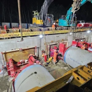
Excavation rates were excellent, especially for the invert section where a surface planing miner was used to trim the last 300mm of chalk. The surface miner planed up to 350m of the full width of the tunnel invert during a 12hr day shift. Chalk spoil was conveyed directly from the inclined conveyor, at the rear of the planer, into Volvo A30 dump trucks.
The planed surface was then cleaned using an air lance prior to blinding using CBM 3 (a dry mix lean concrete blinding). An exceptional accuracy of +/- 10mm was achieved on excavation, by controlling the height setting of the planing drum by means of a remote mounted rotor laser and pole mounted laser readers attached to surface miner.
Related Files
Figure 4 (web only)
Figure 2
Figure 1
Figure 5 (web only)
Figure 3