The Los Angeles County Metropolitan Transportation Authority (Metro) has embarked upon a major capital expansion program to improve public transit service and mobility in Los Angeles County. As part of this program, the USD 1.7bn Crenshaw/LAX project will interline with the Metro Green Line and provide connections to the Exposition Line and Los Angeles International Airport (LAX) along an 8.5 mile (14km) alignment.
The project includes about 3.5 miles (5.6km) of underground construction, involving extensive use of both cut and cover and bored tunneling.
History
In 1967, the Crenshaw/LAX project was included in the region’s first rail system plan. Over the last 40 years it has been the focus of numerous plans and studies by Metro and its predecessor agencies, the Southern California Rapid Transit District (SCRTD) and Los Angeles County Transportation Commission (LACTC).
In 1994, the Crenshaw-Prairie Corridor Preliminary Planning Study clearly identified the need for high-capacity transit improvements.
These options were further developed in 2000 with the Crenshaw-Prairie Route Refinement Study, which identified the need for viable transportation alternatives.
The Crenshaw-Prairie Corridor Major Investment Study (MIS) was competed in 2003 to assist decision makers in evaluating the most effective solution or phasing of solutions to the transportation challenges identified in the corridor while achieving local goals and objectives.
The MIS provided the foundation for including the Crenshaw/LAX project into the Metro Long Range Transportation Plan (LRTP), which led to the preparation of a draft environmental impact statement/draft environmental impact report completed in 2009. Certification of the final environmental impact report by the Metro board of directors occurred in September 2011 and a final record of decision (ROD) from the Federal Transit Administration was received on December 30, 2011. This recommended action is consistent with the adopted 2009 LRTP and the voter-approved Measure R, an America Fast Forward Initiative formally called 30/10.
This will pave the way to restore high capacity transit not seen along the Crenshaw/LAX project since the Yellow Car operations ceased in the 1950s.
If sufficient funding or loans for new infrastructure are secured, the America Fast Forward Initiative will accelerate funding and construction of 12 new transit projects in the Los Angeles area.
Challenges
The Crenshaw/LAX project has faced a number of significant challenges through development including community buy-in, project cost, coordination with local jurisdictions, and construction of a major transit corridor within a busy street environment of Crenshaw Boulevard and the former Burlington Northern Santa Fe Harbor Subdivision Railroad.
Geologic challenges
The Crenshaw/LAX project is located in the northern part of the Los Angeles Basin. The alignment crosses the northwest-southeast trending hills and mesas that follow the trace of the active Newport-Inglewood Fault zone. Numerous producing oil fields occur along this fault zone as well. The floor of the Los Angeles Basin is underlain by Quaternary-age sandy sediments. The northern part of the project alignment along Crenshaw Boulevard is directly underlain by Holocene-age basin deposits and stream alluvium (Young Alluvium) over Old Alluvium of the Lakewood Formation (Dibblee, 1991, 2007).
Most of the these soils were deposited by streams that have meandered across the floor of the Los Angeles Basin such as Ballona Creek, Los Angeles, and San Gabriel rivers. Historic topographical drawings from the early 1900s show streams and marsh deposits near the northern end of the Crenshaw project. Peat and soft compressible clays are common in these historical marshes and are anticipated within the Young Alluvium.
The thickness of the Young Alluvium decreases to the south and Old Alluvium is present at the surface in the southern part of the alignment.
Groundwater challenges
The groundwater table was encountered in the Old Alluvium about 40 – 97ft (12 – 29.5m) below existing grade and is shallowest near the north end of the alignment. Perched groundwater was encountered in the Young Alluvium near the north end of the alignment as high as 15ft (4.5m) below existing grade.
Potential hazardous materials challenges
The alignment traverses the northern margin of the Potrero oil field between La Brea Avenue and Manchester Boulevard, with the Inglewood oil field located to its immediate northwest. The Potrero Field is one of the smaller oil and gas accumulations located along the very oilprolific Newport Inglewood fault trend. The Inglewood oil field’s boundary covers about 1,000 acres, making it one of the largest contiguous urban oil fields in the US. Common problems associated with oil field properties include the release of methane and hydrogen sulfide soil gas, oil seepage, contaminated soils, leaking wells, and wells not plugged and abandoned to current standards.
The proposed Crenshaw/LAX Corridor alignment utilizes both local arterial streets and railroad right-of-ways, and is entirely within urbanized areas. Soil vapor monitoring, groundwater, and soil testing were performed to assess gas and contamination hazards. The main hazards that were identified included abandoned wells, leaky underground storage tanks, and spills associated with railroad corridors.
Seismic design considerations
There are two active faults within the Newport-Inglewood Fault Zone that traverse the project alignment: the Potrero and the Inglewood faults. The LaBrea undercrossing structure to be constructed in a trench has to accommodate up to 4.75ft (1.45m) of displacement with a ratio of 80/20 horizontal/vertical. The Potrero fault crossing is at grade. Along Crenshaw Boulevard north of West Vernon Avenue, there is potential for liquefaction within some sandy soils in the Young Alluvium where perched groundwater is present. Permanent soil deformation associated with liquefactions has to be accommodated by the design. All permanent structures above and below grade will be designed for seismic shaking with no collapse during an earthquake with a four per cent probability of exceedance in 100 years.
They will also be designed to survive relatively undamaged for an earthquake with a 50 per cent probability of exceedance in 100 years.
Underground structures
The Crenshaw/LAX project includes about 3.5 miles (5.6km) of tunnel, in four distinct locations. Three of those locations — Aviation Boulevard Trench (UG-1), La Brea Trench (UG-2), and Harbor Subdivision Tunnel (UG-3) — will be constructed using cut and cover methods. The Crenshaw Boulevard Tunnel (UG-4) is located at the northern end of the project alignment, and is the longest of the underground segments. The tunnel will be constructed entirely within Crenshaw Boulevard from West 48th Street to Exposition Boulevard. The total length of underground construction for this segment is 8,409ft (2,563m), inclusive of two underground stations; Crenshaw/King, and Crenshaw/Exposition. An optional third underground station at Vernon Street will also be considered as a bid option carried in the procurement phase. A summary of the respective lengths of the various construction methods is provided in Table 1. The rest of this discussion focuses on tunneling aspects of the Crenshaw Boulevard segment.
The selection of preferred tunneling methods for the Crenshaw Boulevard segment benefited from lessons learned on several underground projects completed nearby. This includes the City of Los Angeles North Outfall Replacement Sewer (NORS) and East Central Interceptor Sewer (ECIS) projects completed in 1994 by the Shea-Traylor Brothers JV and 2004 by the Kenny/Shea/Traylor/Frontier-Kemper JV respectively.
Related construction experience in Crenshaw/LAX project area
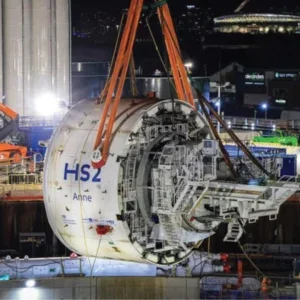
Preliminary engineering studies recommended that the tunnels for this segment should be constructed by tunnel boring, as the most cost-effective and least disruptive solution. The geologic profile of the Crenshaw Boulevard tunnel is shown below.
Crenshaw Boulevard tunnel and soil profile
The project requires the use of pressurized face TBM technology and continuous pressurized-mode operation to minimize the potential for over-excavation so that surface settlement and structure deformation are limited to within 0.5 inch. This settlement performance is expected to be achievable based on performance of the Metro Gold line Eastside Extension (MGLEE). A program of deep settlement monitoring and calibration with face pressures and annulus backfill grouting parameters will be in place to ensure that the settlement tolerances are achieved. The choice of using either slurry or earth pressure balance technology is up to the design-builders. There are many factors affecting the choice of TBM; the gassy conditions and the relatively low fines content of the soils may favor the use of a slurry TBM, but cost and staging area limitations may favor EPB.
The range of anticipated soil grain size distributions is shown below, and may be used to evaluate the use of soil conditioners for EPB. During the preliminary design phase, Hatch Mott MacDonald, Metro’s design lead, recognized that the soil conditions may be challenging from an EPB soil conditioning viewpoint and made surplus soil from sonic soil borings available to the soil conditioner suppliers to investigate the effectiveness of polymers in conditioning the soil.
Soil grain size curves for Crenshaw Boulevard tunnel
For the running tunnels the need for a two-pass lining with vapor barrier to prevent a build-up of naturally occurring gas was evaluated during preliminary engineering. Metro has adopted the double gasket approach used on MGLEE as a standard for their one-pass tunnel linings because of the ability to identify leaks and control the injection of leakage-repair grout. Therefore, double-gasketed precast concrete segments are required for this project. Two improvements over the MGLEE lining design will be implemented for Crenshaw. First, seals are required on the radial joint bolt connections to limit leakage through the inner gasket. Then, cross-bar connections between the inner and outer gasket are required on the radial joints to isolate any leakage through the outer seal so that the location of leaks can be identified.
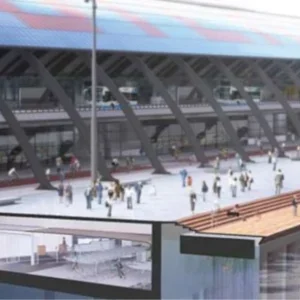
In addition to the main tunnels, cross passages are required within the bored tunnel segment to meet Metro design standards based on the National Fire Protection Association (NFPA) 130 – Standard for Fixed Guideway Transit Systems. Face stability during excavation will be controlled using pre-excavation ground improvement. Ground improvement is envisaged to be accomplished from the surface but could also be implemented from underground at the design-builder’s option, and may consist of dewatering, permeation grouting, soil mixing, or jet grouting. The Crenshaw/King and Crenshaw/Exposition Stations each measure about 390ft (119m) in length by 75ft (23m) in width by 50ft (15m) in depth. An underground crossover structure adds a further 450ft (137m) in length to the Crenshaw/Exposition Station excavation, which may serve as the launch box for the TBMs. A laydown/staging site to be acquired adjacent to the Crenshaw/Exposition Station will serve as the principal staging area for construction.
Typical section at underground station
Site investigations have indicated that perched groundwater will be encountered at depths of about 15ft (4.5m) or less below ground surface. On that basis, an impermeable support of the excavation system comprising slurry walls, secant piles, or similar will be required to prevent excessive groundwater flows into the excavation. The stiffness offered by such wall types will also be required to minimize excavation-induced ground movements in areas with sensitive or culturally significant structures including the Baldwin Hills/Crenshaw mall and the proposed District Square development that is scheduled to be built beginning in 2012 adjacent to the Crenshaw/Exposition Station. These wall types could be incorporated into the permanent structures to maximize the value of the investment in the wall technology, and also serve to minimize the station footprint, provided that Metro requirements for durability, water and gas-proofing, and seismic performance can be demonstrated.
Project delivery
Metro is committed to building on the success experienced with the delivery of the MGLEE project. The approach to the delivery of the MGLEE project, and the lessons learned from this, have helped guide the approach to the delivery of the Crenshaw/LAX project.
Procurement
Historically, Metro has built projects under design-bid-build (D-B-D) delivery approaches utilizing partnering, escrowing bid documents, geotechnical baseline reports, differing site conditions clauses, and in some cases, dispute review boards. With the higher level of construction risk and complexity involved in projects today, Metro chose a hybrid design-build (D-B) procurement for its MGLEE project where the tunnel segment was carried to 100 percent design completion and the final design of the at-grade segment, stations, and systems elements were completed by the design-build contractor. Equally significant was Metro’s adoption of an integrated project management office (IPMO.) This decision was deemed a successful management strategy and is being adopted for all Measure R projects. Metro, partly based on its successful MGLEE experience, has selected designbuild, which will include using an IPMO along the corridor beginning in the PE phase through the construction and startup of the project.
Metro is using a two-phase best value procurement process to select the designbuilder. The first phase is the request for qualifications (RFQ) that was released on December 23, 2011 to solicit interested contractors/joint ventures to submit statements of qualifications that Metro will review and evaluate to determine which respondents are qualified to successfully deliver the project. Those respondents who have been determined to be responsive to the RFQ and qualified will be invited to participate in the second phase of the procurement process, the request for proposal (RFP) scheduled to be released in April 2012, to submit a technical and fixed price proposal. Metro retains the right to request best and final offers from those proposers in the competitive range, then will recommend an award based on the best apparent value to Metro.
Contract packaging
The two contrasting areas of the alignment, an existing railroad right-of-way, and instreet right-of-way, lent themselves geographically to two major contracts: Harbor Subdivision to the south, and Crenshaw Boulevard/Exposition to the north. However, based in part on the feedback received during a contractor industry review period in advance of the RFQ, Metro decided to advertise the guideway, rail, and systems components as a single contract.
In addition to the primary guideway contract, a full service maintenance yard contract is also planned and will be released as an invitation for bid (IFB) in early 2013. A smaller advance utility contract was released for bid in February 2012 to relocate specific utilities along the corridor to minimize impact to the follow-on design-build contractor.


