Case History A – Hydropower project in the design phase
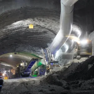
The 13km long power tunnel of a hydropower project (currently at the design stage) passes through complex geological conditions in an active tectonic environment. Nine rock types, including sedimentary, regional metamorphic, contact-metamorphic, igneous intrusive and volcanic rocks as well as fault materials of all kinds will be encountered during tunnel construction. The classification of these materials yielded some 25 rock mass types (RMTs).
Some of these RMTs are fairly similar with regard to basic rock mass parameters (e.g. shear strength, deformation modulus) and typical deformation patterns, but display distinctly different “risk properties”. Risks including karst, swelling, excessive tool wear, etc. are assessed directly from characteristics of intact rock and rock mass. Risk properties including the potential for catastrophic water inflow and for discrete displacements along active faults are interpreted from field observations, literature, seismic data, etc. and require a profound understanding of general and regional geological correlations and engineering geological experience.
The area’s extremely rough terrain and high overburden limited the possible amount and methods of investigations. These constraints resulted in a more general classification approach, such as shown in the classification sheets for RMT-7b1, a moderately tectonised carbonaceous conglomerate (Figure 1), and for RMT-11b, clayey fault gouge material (Figure 2).
The numbering system for rock mass types (RMTs) indicates the rock type (lithology) with numbers 1 to 10 (11 stands for fault materials, independently from parent rock), and the degree of tectonisation (“a” for slightly tectonised, “b1” for moderately tectonised, “b2” for highly tectonised).
The power tunnel will be excavated mechanically along most of its extent and by the conventional cyclic drill and blast method along particular sections. The risks identified will essentially influence the selection of a TBM, the design of the segmental lining and the design of the temporary support.
Case History B – Urban infrastructure tunnel tender design
In contrast to the previous case history, the alignment corridor for a planned shallow urban traffic tunnel could be investigated far more thoroughly.
The tunnel alignment passes through schists and granites that occur in close association along an intrusive interface overprinted by intense tectonic shearing. The rocks are weathered and disintegrated to various degrees. Six rock mass types (referred to as geotechnical units) were defined for the tender design.
Typical rock mass characteristics/behaviour and failure modes for schists and granites could be observed in cut-slopes of an adjacent construction pit (Figure 4). Typical behaviour patterns and risks for granitic rock mass have been assessed from previous infrastructure projects and were experienced during the construction of some of these projects.
With the drive direction and discontinuity patterns known, a detailed kinematic failure analysis could be performed. A sketch indicating the anticipated modes of wedge failure was included in the classification sheets for each rock mass type, as shown in Figure 3 for geotechnical unit X3.
Conventional cyclic tunnel excavation is foreseen for the project. The rock mass characterisation allowed the development of routine temporary support classes as well as special measures to be employed in case of “risk events” (e.g. piping and erosional failure along disintegrated granitic dykes, etc.).
Conclusion
The concept for rock mass characterisation proposed in this paper combines quantitative and qualitative rock mass classification systems.
The process can be individually adjusted by employing a variety of methods. Key elements including rock and rock mass properties, circumstantial influencing factors, geomechanical parameters, typical rock mass behaviour, failure modes and geotechnical risks are described in a classification sheet for individual rock mass types that are correlated to quantitative standard classification systems.
All descriptions and assessments are performed according to international and/or national standards/methods, allowing for a transparent and reproducible classification process. The scheme systematically aims towards a) the definition of typical rock mass behaviour and b) the recognition and description of geotechnical risks.
The product is the definition of rock mass types (RMTs) that supply the conclusive information required for tunnel design as well as for ground-related contractual issues.
Related Files
Fig 1 -Classification sheet for moderately tectonised conglomerate, rock mass type RMT-7b1
Fig 3 – Classification sheet for highly tectonised schist with granitic dykes, rock mass type X3
Fig 2 – Classification sheet for fault gouge material, rock mass type RMT-11b