The UK’s Channel Tunnel Rail Link (CTRL) Contract 250 comprises two 7.15m i.d. tunnels, driven from the Ripple Lane Portal, in Dagenham, to the Barrington Road Shaft, in Ilford, a distance of 5.3km. The tunnels were constructed using Earth Pressure Balance TBMs mainly through the Upnor Formation and Thanet Sand and under sensitive railway infrastructure.
The final 1.4km of the drives was beneath the Barking railway complex (Figure 1), a strategic railway junction in East London, which is used by London Underground Limited (LUL) and Network Rail (NR) 24hrs/day.
The route and construction of the CTRL was authorised by Parliament. However, in order to gain specific consent to tunnel under the railways, the CTRL team had to get prior approval by providing safety assurances to the surface railway authorities.
Possible means of achieving this might have included extensive advance works to attempt to gain comfort by reinforcing track and structures. Alternatively, high-frequency monitoring by conventional survey, with teams working extensively around the live railway, could have been used to detect problems.
After due consideration of all the options, the team decided to develop a system of real time remote monitoring of the surface railway infrastructure, backed up by contingency plans to deal with the consequences of large movements. This system was felt to provide an efficient means of solving the problem with minimal exposure to the safety risks of working in the railway environment.
Tunnelling and affected infrastructure
Tables 1 and 2 describe the geology and tunnelling horizon across Contract 250 and the Barking area. The Upnor Formation and Thanet Sand were dewatered prior to and during the TBM drives to aid the tunnelling process.
The CTRL tunnels were constructed using a pair of 8.15m o.d. Lovat EPBM’s. Both machines were operated in closed mode throughout the length of the drives. Earth pressure balance and lubrication of the spoil was maintained by injecting foam and polymer into the head, with excavated soil being removed from the face by and taken back to the Ripple Road portal by conveyor.
Table 3 lists the major structures within the Barking railway complex.
Automated Monitoring requirement
Manual survey monitoring was considered unsafe within the Barking railway complex, and would have contravened recently introduced RIMINI (RIsk MINImisation) rules for working on or near NR infrastructure. It would also not provide monitoring data on a 24/7 basis, as stipulated by LUL.
To gain approval from both LUL and NR to tunnel under the Barking railway complex and to eliminate the risk to the survey teams it was decided to utilise an Automated Monitoring System (AMS) that could provide constant x, y, z (i.e. 3D) monitoring data.
Following on from experiences gained early on in the C250 TBM drives with semi automated systems, it was decided that the most suitable system to use at Barking would be GeoMoS supplied by Leica.
Design of the monitoring regime
The scope of the task was identified by reviewing 1:400 scale drawings which showed:
Drawings were marked up to indicate possible positions where Robotic Total Stations could be sited. Walkovers of the site (reconnaissance) were then conducted to view these locations and to investigate where ground and structure monitoring targets could be located. Photographs were taken to assist in visualising the task at hand and to help in identifying locations with poor sightlines.
Drawings were revised accordingly and, once the results of structural assessments were incorporated, the placement of the structure monitoring targets was finalised.
Ground monitoring targets were installed at 10m centres along the centre lines of the tunnels. Transverse monitoring arrays were installed at approximately 50m centres. The transverse arrays were required to demonstrate that the TBMs were being driven at less than 1% volume loss, as this was a condition of the contract.
Monitoring targets were also installed onto the railway lines to monitor any change in their geometry, which could affect operational safety. The targets were attached to ‘rail-shoes’ that were clamped to the bottom flange of the running rails.
The results of the structural assessments also provided trigger levels for allowable movements of the affected structures. Three alert levels were defined:
The trigger levels for ground movements were set in terms of calculated volume loss.
Once the monitoring targets were installed a series of baseline readings was taken to provide a stable reference to compare changes as the TBM’s passed through. The base-lining exercise also provided the JV with time to ‘shakedown’ the system and iron out any bugs.
The drawings and photographs of the Barking Railway Complex also helped to make up the basis of presentations to LUL and NR. The C250 JV and RLE needed approval from both of these bodies if tunnelling work was to proceed through Barking.
Initial set up and operation of the AMS
The AMS used robotic total station instruments (e.g. Leica TCR1100) with auto target recognition (ATR), mounted on pillars adjacent to the monitoring zones. These instruments were controlled by two server computers, which ran the Leica GeoMoS software. When the monitoring targets had been installed a typical robotic total station was set up by a surveyor from the JV, who would define a cluster of prisms as a ‘pointgroup’.
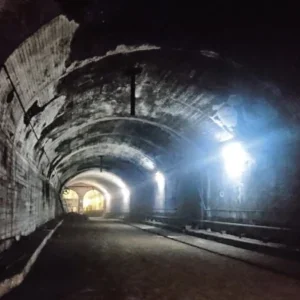
Initial baseline readings would be observed by the surveyor and then transmitted back to the GeoMoS server, using radio modems (e.g. Leica TP26 and PDL). This action would effectively ‘train’ GeoMoS to recognise a ‘pointgroup’ and would then remember where it was in 3D space. Figure 2 shows a surveyor at a monitoring station setting up a monitoring system at the River Roding.
Having completed this part of the initial set up additional baseline readings were observed for the following reasons:
The frequency of monitoring observations corresponded approximately with a ‘muck and ring build’ cycle on the TBMs. On average a typical muck and ring build cycle might well be 45 to 60 minutes, so the AMS was set up to try and make at least one observation during each cycle. This meant that fast, accurate data could be relayed to the tunnelling teams and RLE/JV senior management.
In total 17 Total Stations (Figure 2) operated simultaneously observing up to 1000 targets.
Management of AMS monitoring and TBM data
The observed data from the monitoring stations was transmitted back to the GeoMoS server and was stored in SQL (structured query language) format. GeoMoS has a facility to export the monitoring data in CSV (comma separated values) format to a spreadsheet program, to allow further analysis of the data. In general terms, when the data was exported, the spreadsheet then became the primary tool for managing the data.
Spreadsheet macros were developed within the RLE/JV team to create two simple user interfaces for the management of the AMS:
Graphical spreadsheet outputs were part of the management strategy for the C250 TBM drives through Barking. Time history and transverse monitoring array graphs were produced to help engineers and senior management make informed judgements about the performance of the TBM, ground movements and the performance of affected structures.
In addition to the graphical data analysis the management strategy also ensured that there was a 24 hour engineering presence in the TBM control room. This engineer constantly monitored the TBM performance and also had a computer dedicated to interrogating the AMS system. Additionally, the system allowed engineering management to dial in remotely.
Formal recorded meetings were held twice daily to review the AMS monitoring data and data from the TBM. TBM data usually comprised the following:
Checks were made to ensure that the trends from the time history graphs were not approaching set trigger levels and the TBM parameters for the next shift were agreed between RLE and the JV. Open invitations to the monitoring reviews were always extended to third parties (LUL and NR), to demonstrate that the TBM’s were being driven safely.
Volume losses were calculated during the TBM drives. Typically the range of volume losses between Barking station and Barrington Road Vent shaft were in the region of 0.5% to 1.0%.
Following the meetings, reports were drafted and distributed to third parties, RLE and JV senior management and to the tunnelling and survey teams, to ensure that all project employees were up to date with TBM progress and ground and structure movements.
Conclusion
The successful completion of the tunnelling works beneath Barking demonstrated that large diameter EPBM’s can be successfully driven under live railways and infrastructure.
Expensive mitigation works were avoided by careful TBM operation based on constant monitoring data. Large volumes of data can be managed using off the shelf computer hard and software.
Related Files
Table 2: Material properties of tunnelled horizon through Barking
Table 1: General geology across C250
Table 3: Affected structures in the Barking area