HAMPTON ROADS IS ONE OF the world’s largest natural harbours. Five miles wide in places, it is formed where the Elizabeth, Nanesemond and James rivers flow together to empty into Chesapeake Bay. The surrounding region is home to some 1.7 million people, in the metropolitan area of Virginia Beach, Norfolk, Newport News and other conglomerations; and also, significantly for this project, it hosts the biggest naval station in the world, at Norfolk, Virginia. The largest fleet of the world’s largest warships sails down Hampton Roads; so putting a bridge, even a draw-bridge, over the channel is ruled out by US Navy requirements. Such a structure, if destroyed in wartime or due to natural disaster, might block the vital shipping channels.
Instead, Hampton Roads is traversed by a number of road tunnels – no fewer than nine of them at various sites along it. These, from a tunnelling point of view, are historically interesting. The first of them was completed in 1952 as the Elizabeth River No. 1 (now the Downtown Tunnel, westbound); the most recently completed is the Second Midtown (now the Midtown Tunnel, Westbound), opened in 2016. All but one are two-lane tunnels; and all were constructed as immersed-tube tunnels. The soft soils of the region made this the only feasible method at the time they were built. Even so, they were major achievements.
“The 1952 crossing was shore-to-shore, with 638m immersed length, but the next tunnel chronologically, the 1957 Hampton Roads tunnel, had to span the entire 5.6km (3.5mile) mouth of the Virginia Harbour”, says Martha E. Gross, technical director of the Virginia Department of Transportation. “Ventilation technology at that time was not sufficient to support this length of tunnel without intermediate shafts. Since the Navy’s restrictions applied only to the navigation channel, not to the non-navigable inshore waters which are only a few feet deep in places, engineers developed the idea of constricting two artificial islands bordering the channel. Trestle bridges connect these to the shore, and the tunnel runs between the islands.” Even with that shorter distance the tunnel, Gross says, was extraordinarily long for its day: “When it opened in 1957, with an immersed length of 6,859ft (2,090m) it was the longest subaqueous tunnel in the world.” It was also the first time that an underwater tunnel had been built between two artificial islands.
That tunnel joins the two coastal cities of Hampton and Norfolk, as part of the interstate highway I-64. In 1976, a second, parallel, tunnel was added, between the same artificial islands; it now takes the westbound traffic, in two lanes, while the 1957 tunnel takes the eastbound. Between them they form the Hampton Roads tunnels.
Today, however, even with that doubling of capacity, the Hampton Roads Tunnels are greatly overloaded. Traffic exceeds 100,000 vehicles a day during peak summer traffic. The I-64 corridor is one of the most congested in the region. For many years expansion schemes have been debated; now one is happening.
The Hampton Roads Bridge-Tunnel Expansion project will widen ten miles of the interstate highway I-64 in both directions. Two new 3.5-mile (5.6km) two-lane tunnels will be built; again, they will start and finish at the same two artificial islands that serve the existing tunnels. The present tunnels will accommodate the westbound traffic and the new tunnels will accommodate the eastbound. Capacity will expand from two lanes in each direction to three full-time lanes, plus a peak-hour shoulder lane, in each direction. As today, two lanes in each direction will be free and untolled. The additional capacity will be priced as ‘high occupancy/toll (HOT) lanes: the toll rates will vary throughout the day. They will be dynamically set depending on congestion levels.
The design-build contract for the entire 16km scope was awarded by the Virginia Department of Transportation (VDOT) in April 2019. The overall cost is US$3.8 billion, which makes it the largest highway construction contract in Virginia’s history.
The design-builder is Hampton Roads Connector Partners, a joint venture of Dragados USA, Vinci Grands Projects, Flatiron, and Dodin Campenon Bernard, with HDR and Mott MacDonald as lead designers. The quotations that follow are from the engineering team of the consortium; they requested to speak as a single voice.
PROCUREMENT
The contract procurement was not by design-bid-build. Instead, in December 2017, the Virginia DOT issued a design-build request. Parameters for eventual performance were set out – essentially four new lanes across the waterway – and proposers were invited to submit their ideas for achieving them. Three teams were shortlisted in April 2018, and a request for proposals was issued in May 2018.
The intention was to encourage innovative solutions from the builders themselves, but it was recognised that in some areas, differing interpretations of performance-based specification could introduce unintended risk – whether for the proposer, the project or the public. A higher-risk proposal could potentially offer a lower bid price, and VDOT did not want to incentivise this strategy. Nor did they want to encourage a design that reduced construction costs at the expense of greater operation and maintenance costs in the future; the goal was to ensure that proposers competed on their merits rather than on their appetite for risk. VDOT therefore structured the selection criteria to reward lower-risk approaches.
“This still left the shortlisted teams free to propose what to construct and how to construct it”, says the JV team. VDOT had assumed the tunnels would be immersed-tube, but bored-tunnel technology has advanced in recent years. Two of the proposers submitted TBM-based approaches; the third submitted only for an immersed-tube solution. But maritime stakeholders – which includes the US Navy – expressed concerns that immersed-tube construction operations in the navigation channel would be sharing the seaway with up to 8,800 shipping movements a year, with potential risks to both shipping and tunnelling. Bored construction would impinge on shipping only insofar as material deliveries and muck disposal would be by water – still a consideration, but a less intractable one. At this point, the immersed-tube proposers dropped out.
Similarly, the choice of one four-lane tunnel or twin two-lane tunnels was open to the proposers. “The procurement criteria did not preclude a single large four-lane tunnel” say the JV TEAM, “but both remaining proposers independently developed concepts with twin two-lane bored tunnels as their solution. In this soft-soil marine location, the greater buoyancy of a single large tunnel would have required a notably deeper alignment to counteract these buoyant forces.”
GEOLOGY
“The geology of the Coastal Plain of Virginia consists of late Jurassic and Cretaceous clays, sands and gravels, which were transported from the Appalachian Mountains and deposited in the Atlantic Ocean basin” they explain. “The subsurface materials that we anticipate within the tunnel alignment overlie these sediments and comprise younger Tertiary and Quaternary layers. The stratigraphy along the tunnel alignment varies from loose coarse to stiff cohesive soils, giving different combinations of mixed-face conditions. The TBM will also have to bore through different types of ground-improved areas.”
The main tunnelling difficulties are the presence of clay and the changing geology along the alignment. To accommodate this, an adaptable Variable Density TBM was designed.
EXPANDING THE ISLANDS
At the North Island, additional land must be reclaimed westward to accommodate the shaft and portals for the new tunnels. The footprint of the North Island will be expanded by 15 acres (6ha) by constructing a new rock perimeter which will be filled with sand. The South Island, however, is large enough to fit not only the new tunnels’ approach structures but also the tri-cell launch shaft (97.5m long by 47m wide) for the TBM. This is because South Island was considerably enlarged, with surcharge needed for consolidation of the particularly soft soils at this location, during construction of the second HRBT tube in the 1970s.
When the islands were first built, large armour stone and gravel-sized crushed rock filter layers were placed around the perimeters to provide scour protection and maintain their outline. These are a potential obstruction to the TBM. To minimise their impact a deep alignment of tunnel has been chosen, to pass under most of the anticipated obstructions.
Going deep reduces the obstruction zone through the armour stone to approximately 400 linear feet (122m) adjacent to the tunnel portal on the South Island, well within the island footprint. The deep alignment makes for a longer tunnel than a shallower one and implies a higher face pressure (up to 6bar) that the TBM must be designed for, but it enables favourable offshore ground cover to allow pressurised TBM excavation and interventions. This is particularly helpful at the South Island shoreline, where it eliminated the need for temporary berms, which in turn would necessitate an island expansion. Ultimately, this concept allows building an independent tri-cell launch shaft within the existing South Island footprint and therefore decouples the island expansion works from the tunneling works.
The length of each tunnel is approximately 2,408m (7,900ft) between the launch and reception portals – that is, between the two islands. The TBM will excavate at depths which will vary from around 12.2m (40ft) to 45.7m (150ft) measured at the tunnel axis. At these depths, the tunnel will run completely under the water table.
A single TBM will be used making two runs, first northwards, then back south. It is a Variable Density (VD) Herrenknecht machine, 46ft (14m) diameter – which makes it the second-largest TBM ever to have been used in the United States (the largest was 57.5ft/17.5m-diameter and bored the tunnel to replace Seattle’s Alaskan Way viaduct).
The Variable Density machine will pump slurry to the front of the excavation; a screw conveyor will carry soils from the excavation chamber to the rock crusher, where larger rocks are broken in smaller pieces to be collected by the slurry pipes and transferred to a slurry treatment plant (STP), with 3,000m3/hr capacity, located on the South Island above the two new tunnels. The muck will be transported to the STP on the South Island for both drives using 550mm (22in) diameter pipes, along with three feed pumps (1 STP, 1 North Shaft, 1 TBM) and three booster pumps (1 per tunnel + 1 TBM), each 6.7m (22ft) long by 3.7m (12ft) tall.
Once the spoil reaches the treatment plant it passes through a series of rotating screen filters (trommels and cyclones) with progressively smaller mesh sizes to separate the gravel and finer sands from the bentonite and water. The recovered bentonite and water are reused to feed the TBM. The remaining spoil is fed into bags and then pressed to squeeze out the remaining water. The dried spoil is dropped onto a floor slab below for collection and disposal.
Muck removal is by barge, with a back-up possibility of trucking. An offshore conveyor with a capacity of 1,500tons/hour will be installed at the northwest corner of the South Island to transport excavated material for disposal. The spoil from the rotating filters will be discharged onto a short, inclined conveyor belt on a rotating stacker, which either feeds the main offshore conveyor directly or rotates and temporarily stores the material in a dedicated mucking area. A moving tripper belt, 1.6m (5.2ft) wide, is mounted at right angles to the main conveyor belt (which is 1.2m (3.9ft) wide) and travels along the length of this conveyor to discharge the spoils into hopper barges located either left or right of the conveyor. Two barges can be moored at any time alongside the offshore conveyor, ensuring one barge is always available to receive spoil and allowing the TBM to progress smoothly.
The same equipment is used to transfer any spoil temporarily stored in the mucking area onto the conveyor to the barges, or it can also be used to load this material onto trucks. A truck lane parallel to the edge of the island has been designed to allow loading trucks to be kept separate from the main circulation road on the island. The trucking cycles and existing traffic conditions will be optimised to allow a partial trucking disposal solution, generating additional certainty for maintaining TBM production in case of weather conditions that are unfavorable for marine transport and disposal by barge.
TUNNEL LINING
The segmental lining is one of the most space-consuming inputs to be delivered to the South Island to supply the TBM. With an exterior ring diameter of 13.56m (44.5ft) and nine segments per ring, each element’s overall footprint is approximately 2.03m (80in) wide and 4.75m (15.6ft) long. These elements weigh 12 short tons (11 tonnes) each; if shipped by land, only two can be delivered per truckload. They will be manufactured at a facility in Cape Charles on Virginia’s Eastern Shore, located across the Chesapeake Bay about 40km from the jobsite.
For these marine deliveries, the quay will include a near-shore platform with a minimum storage capacity of 36 rings (324 segments), as well as an offshore barge slip with sufficient water depth for the high-capacity barges that will be docked there. The elevation of the quay platform is designed to safely protect the segments from sea-level variations throughout the project duration, as well as to allow delivery of the TBM and other heavy equipment with roll on/roll off operations using self-propelled modular transporters (SPMTs). The anticipated barge layout envisions a capacity of up to 18 rings (162 segments) per barge, which represents additional site storage capacity as one barge will constantly remain docked.
To load the segments from the barge or storage platform onto the multi-service vehicles (MSVs) supplying the TBM, there will be a heavy-duty gantry crane travelling from the quay’s barge slip to the shaft. With an ISO M7/8 duty rating (similar to 4m, H5, or Class E service under other rating schemes), this crane is designed with particularly robust components to lift heavy loads constantly and remain in operation 24/7. This crane has a lifting capacity of 44tons (40mt) and is designed for offshore conditions in a hurricane area. Since the cycle-time analysis initially indicated gantry-crane operations could become a potential bottleneck for the project, the crane’s runway (rail) was improved during the design phase by extending its range from over the shaft and the storage platform up to the end of the barge slip. This allows the TBM to be supplied directly with elements recently arrived by barge, thus reducing the overall number of lifting operations by bypassing the intermediate step of placement in the storage area. The north-side overhang of the gantry crane also allows transferring materials between the shaft and the surface.
This efficient offloading configuration allows supplying not only precast segmental liners but also precast concrete invert sections which are set along the bottom centreline of the tunnel and are required for buoyancy control in some portions of the tunnel. As shown below, the precast concrete serves as the first layer of ballast. It also provides a flat surface for two lanes of construction traffic: one for interior fit-out operations, and one for MSVs transporting the TBM’s inputs. To maintain the project schedule, it is necessary to start building the tunnel’s interior structures before the end of the mining process.
Each invert has the same length as the segmental ring – 2.03m (80in) – and will be placed by the TBM crane and its specifically designed vacuum plates as part of each ring cycle. Each segment weighs 12tons (11mt), but the erector has been designed to set the 22ton (20mt) inverts as well.
Finally, the tunnel’s temporary utilities can also be offloaded by the gantry crane from barge or trucks and transferred directly to the MSVs, as these utilities are currently designed to be packed and transported in metal boxes as a modular kit equivalent to six rings of supply, containing all the necessary inputs for the TBM to advance (pipes, utilities, grease, oil, etc.).
With the alignment of the project crossing such an important channel, the presence of nearby shipping is a major consideration. The project will transport hundreds of shipments by barge – including outgoing excavated material and incoming construction supplies – so coordination with maritime stakeholders will be key to minimise any impacts to vessel traffic through the channel.
SAFETY
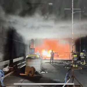
The new tunnels are designed with an egress corridor as an evacuation route in case of fire or emergency. This egress corridor is physically separated from the roadway by a concrete wall, with access from the roadway into the corridor via sliding doors spaced approximately every 195m (640ft). Cross passages are not considered for the new tunnels. The egress corridor in each tunnel provides a safe evacuation route in an emergency.
VENTILATION
Pairs of jet-fans above the roadway provide ventilation. Additionally, the ventilation buildings located at each island keep the plenum above the egress corridor pressurised. In case of a fire, the jet-fans would work so the smoke flows in the direction of the traffic, protecting potential trapped motorists behind from the smoke. In parallel, the booster fans installed in the plenum slab would transfer the pressure from the plenum to the egress corridor in order to keep the smoke from entering the evacuation route while the motorists escape.
To access the tunnels, the existing North and South trestle bridges from the islands to the Hampton and Norfolk shorelines will be demolished and replaced with wider structures accommodating four lanes of traffic in each direction. The new North Trestles (approximately 914m/3,000ft long) will be two separate four-lane bridges; the South Trestle (approximately 1,829m/ 6,000ft long) will be one eight-lane bridge. Four lanes of traffic – the current capacity of the highway – will be maintained in both directions at all times during construction.
The TBM is currently under construction by Herrenknecht in Germany. It will take approximately four months to ship it and another five months to assemble it on the South Island in a 20m-deep shaft. Tunnelling is expected to begin in early 2022 and to progress at a rate of about 15m per day. The project is currently scheduled for completion in November 2025.


