In the last decade restoration and revitalization efforts have ushered in Whiskey Row to downtown Louisville. This block-long stretch on West Main Street once served as home to the bourbon industry, weathered the ravages of a fire and is now a hot spot for whiskey distillery experiences, dining and shopping.
Ornate 19th century buildings are being joined by chic hotels and loft-style apartments, as the area draws in new offices, creating a hub for business and catering to the nearby convention centre. The idea of ripping up streets and closing down the area from traffic, for up to two years, to build three underground storage basins is less than ideal.
About 15 years ago as the Louisville/Jefferson County Metropolitan Sewer District (MSD) began preparing and designing its CSO abatement plan (see Consent Decree page 25) it focused on a series of underground storage basins. John Loechle, Louisville MSD’s engineering director, explains, they did consider tunnels among the alternatives, but the cost and technology, at least in the Louisville area at that time, was a deterrent.
Initially MSD identified 13 offline storage basins as a way to capture and store CSO during rain events. Nine basins have been built. When MSD entered the final stages of the program– design of the last four storage basins–it became apparent another solution was going to be required to avoid disruptive construction downtown. This led to the implementation of the 2.5-mile, 20ft-diameter (4km, 6m) Waterway Protection Tunnel. The tunnel initially replaced three basins, but ultimately would be extended beyond its original scope to eliminate the fourth remaining storage basin for a total length of 4 miles.
Design Expedited
MSD had established a five-year schedule for the basin project: two years for design, permitting and easement acquisition, and three years for construction. The biggest challenge in designing the tunnel, according to Jacob Mathis, engineer and project manager for MSD, was the timing with the consent decree’s hard deadline of December 31, 2020. “When we identified the problems and decided to switch to a tunnel, we still had to keep the design schedule to get construction underway.”
During the summer of 2016, MSD made the decision to abandon the storage basins and move forward with a tunnel. The basins had already been in the design process for at least one year. Design time on the tunnel project was accelerated to an eight-month schedule.
Working with Black and Veatch, MSD’s engineer of record, the agency describes a team effort drawing on as many resources as possible to finish the design in time, with good communication.
“Luckily we’ve had a lot of experience on recent projects in the area, and in the region, with similar geology,” explains Jonathan Steflik, engineering manager with Black and Veatch. “Other Black and Veatch team members worked in Louisville and had already done a subsurface investigation before the design started.
“There were a lot of long hours. We had teams in multiple offices working around the clock to finish the design of the tunnel.”
Mathis explains another important strategy: “Once we made the decision to move forward we sketched out our preliminary alignment, called all the other governmental agencies that would be affected, sitting down with them early in the design, asking about any issues and setbacks up front and adjusted the design as we went.”
One of the biggest issues for the project is the convergence of three of the US’ major interstates (I71, I65 and I64) in Louisville, which includes elevated sections in the area of the tunnel alignment (Figure 1). The tunnel also crosses under a flood protection system owned by the United State Army Corps of Engineers (USACE), a federally-owned parcel of land used for the McAlpine Lock & Dam, the Ohio River for approximately 2,000 linear feet and CSX Transportation railroad tracks, among other natural features and important local streets.
MSD says this proactive approach with the regulatory agencies, meeting with them regularly for feedback, allowed permitting to happen quickly and avoid any last minute revisions.
Relying On Rock
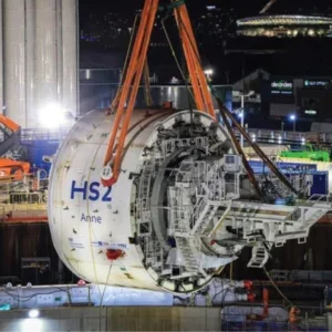
A 22ft (6.7m) diameter Robbins TBM will excavate the tunnel. The 20ft internal diameter was selected based on the original 2.5-mile length to meet the capacity required for the consent decree.
Mathis explains the required volume was 33.7 million gallons and this geometry provided 37 million gallons. When MSD extended the tunnel to 4-miles, this increased capacity to 55 million gallons.
Another factor was equipment. “We looked at that sweet spot for TBMs,” adds Alston Noronha, construction manager and geotechnical engineer with Black and Veatch, “16ft, 18ft to 25ft is more what you see for TBMs in North Amerira…this size opens up the market.”
During geotechnical investigations they looked for the best available rock without going too deep, to avoid the costs and efforts of deep shafts. Roughly mid-point of the original 2.5-mile alignment the soil-rock interface was significantly deeper than either end.
Ensuring two tunnel diameters of rock cover would put the tunnel somewhere around 175-185ft (53-56m) below ground.
“The geology of Louisville is erratic compared to Indiana because of the arches that formed during glaciation,” Noronha says.
The project geology consists of overburden soil underlain by sedimentary rock formations. The overburden consists of manmade fill, alluvium and glacial outwash deposits. The rock formations include shale, limestone, and dolomite from the Devonian, Silurian, and Ordovician geologic time periods. During the geotechnical investigation, a small pocket of Waldron shale was found near the downstream end of the tunnel, which he describes as not self supporting, and quick to degrade compared to the limestone dolomite elsewhere.
Tunnelling through the shale would require additional and almost immediate rock support, including shotcrete to minimize its exposure to air. They lowered the alignment another, approximately 20ft to stay in the more competent rock while still achieving the velocity needed for a self-cleaning tunnel. The TBM drive will be between 185 and 215ft below ground.
“The formations dive through ages all in the matter of just 50ft of elevation,” Noronha says, adding “we expect good tunnelling hence we went with the main beam TBM rather than an EPBM or slurry.”
Contractor JF Shea will do a cast in place 12-inch thick concrete liner, a majority of which will be unreinforced concrete. The only sections to receive reinforcement will be those that pass beneath a Kentucky Transportation Cabinet facility or the Corps’ flood protection system. The reinforcement consists of a single mat with #7 reinforcing bars spaced at 12-inch centers, each way. Other requirements for the project include passing under the interstates at a perpendicular angle. The final tunnel alignment has a 0.2 per cent grade with 11 curves: seven 1,000ft curves; one 1,300ft curve; two 2,500ft curves; and one 4,000ft curve. It also includes an approximately 1,200 linear foot bifurcation to one of the drop shaft locations. With the highway infrastructure above, drill and blast construction is prohibited.
The contractor will turn the TBM, tunnel to the drop shaft location, reverse out, realign and continue on the main drive. The TBM is owned by JF Shea, and was rebuilt in their yard in Mount Pleasant, Pennsylvania. It was last used on a tunnelling project in Milwaukee, approximately 10 years ago. JF Shea selected the TBM, a main beam, based on the rock conditions and expected volume of groundwater flow. Grouting will be important on this job, the design team confirms.
The project team has experience on other tunnels with similar ground conditions, and has incorporated some enhancements or lessons learned from those projects into this TBM’s design. The structural components between the bridge and the first deck have been modified to improve structural stability while backing-up the 412ft-long TBM from the tunnel bifurcation—the team says backing up should go smoothly.
In addition, the scrubber unit has been augmented with filters to handle moist air during reaches of relatively high groundwater inflow. The TBM cooling system has been made more efficient and pneumatic hammer rock drills will be used for probing ahead of the TBM, instead of rotary wash drills.
Construction crews are working five days per week, 24 hours per day, with some Saturdays being worked as necessary to keep schedule.
On the ground
The final piece of the TBM arrived right before Thanksgiving. Crews are assembling the TBM at the bottom of a 220ft- (67m)-deep, 48ft- (14.6m)- diameter shaft just west of downtown Louisville, which is connected via a section of drill and blast to another shaft of the same dimensions for the pump station, allowing for space to accommodate the TBM.
There are eight shafts in total; others include the retrieval shaft of 33ft in diameter, and five drop shafts of 8 to 12ft diameters. There is also a temporary shaft, approximately 2ft in diameter, along the tunnel route for concrete lining operations.
Crews have used secant pile construction through the overburden followed by drill and blast to excavate the larger shafts and one drop shaft. The retrieval shaft is being constructed using steel ribs and liner plate in the overburden followed by drill and blast construction through the rock, and the remaining drop shafts will be built using steel casing driven through the overburden followed by raise bore to excavate the rock.
A majority of the construction staging is taking place on property acquired in fee simple arrangements by MSD—vacant and former commercial properties and vacant Kentucky Transportation Cabinet right of way—or easements acquired from both privately-owned vacant commercial or local-government owned property.
Mathis explains a lot of the vacant property available downtown is former industrial areas, like the location of the launch shaft, which had seen various industries along the riverfront over 150 years. Soil contamination caused concern during the secant piles with classified disposal measures.
When the Waterway Protection Tunnel project is operational at the end of 2020, the job sites at both the launch and extraction points will become new, clean public green spaces.


