The city of toronto is implementing the Don River and Central Waterfront (DR&CW) Project to reduce Wet Weather Flow (WWF) into Lake Ontario, the Don River, and Taylor Massey Creek. A primary goal is to de-list the Don River and Inner Harbour as an International Joint Commission “Areas of Concern” in the Great Lakes Basin. Black & Veatch in association with R.V. Anderson Associates Limited (design team) has been contracted by the city to complete preliminary design of the project and detailed design of construction Stage 1, and to scope and manage the geotechnical investigations. The geotechnical program is currently under way and is being completed to support preliminary and detailed design of all five construction stages.
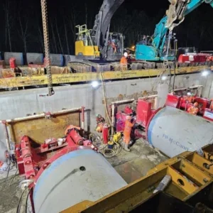
The DR&CW Project encompasses design and construction of the following components: 22km of tunnels in both rock and soft ground with 12 shafts and 27 connections, seven detention tanks, and a high rate treatment facility at Ashbridges Bay. The project is expected to cost CAD 1.5bn (USD 1.23bn) and be implemented over the next 25 years in the following five construction stages:
¦ Stage 1: Inner Harbour East (IHE) and Lower Don (LD) Tunnels (i.e., Coxwell Bypass Tunnel),
¦ Stage 2: Taylor Massey (TM) Tunnel,
¦ Stage 3: Offline Storage Tanks,
¦ Stage 4: Inner Harbour West (IHW) Tunnel, and ¦ Stage 5: WWF Connections (WWFC) to tunnels.
For Stages 1, 2, and 4, refer to Figure 1 on page 39 for an overview of tunnel properties. Shaft internal diameters range from 8m to 22m, and the maximum shaft depths in soil and rock are 60m and 43m, respectively.
GENERAL SUBSURFACE
CONDITIONS
Across all five construction stages of the DR&CW Project, quaternary soil deposits overlie shale bedrock of the Georgian Bay Formation.
The soil was deposited during the Wisconsinan glacial period. It is a complex distribution of glacial till layers separated by interstadial deposits of sands, silt, and clays. These deposits were laid down by glaciers and associated glacial rivers and lakes. (Golder, March 2017)
The bedrock is an Ordovician-aged shale from the Georgian Bay Formation. It is generally classified as a weak rock with a low hydraulic conductivity and hard interbeds of limestone and siltstone. The upper 3m to 5m layer is more fractured and weathered. Buried bedrock valleys exist and have been subsequently infilled since the last glaciation. (Golder, March 2017)
Regional groundwater flow in city aquifers is mainly to the southeast with an ultimate discharge to Lake Ontario. Local groundwater flow deflections occur in proximity to surface water or valley features, particularly in shallow hydrostratigraphic units (Golder, March 2017).
While the behaviour of the shale bedrock within deep shaft and tunnel excavations is well understood by local consultants and contractors, for the scale of the DR&CW Project it was prudent to both confirm past knowledge and search for site specific anomalies.
GEOTECHNICAL INVESTIGATION PROGRAM
The ongoing geotechnical investigation program is intended to define the top of bedrock elevation and obtain subsurface properties relevant to the design of the various components of the DR&CW Project. As of mid-July five phases of field work are complete, one phase is under way, and various reports are being written/finalized.
Quality assurance and peer review
The design team engaged Dr. K. Y. Lo to act as a high-level QA/QC advisor. His scope of work includes continual review of ongoing geotechnical investigation results, guidance on preliminary tunnel designs and construction monitoring, assistance in developing the Geotechnical Baseline Report (GBR), and providing expert opinion on local in-situ stresses and rock swelling.
Prior to initiating the geotechnical program, the design team conducted a pre-consultation with five geotechnical companies. This was to assist the design team in determining the broad scope of work required for the DR&CW Project. The five companies were AMEC Foster Wheeler (AMEC), Golder Associates Ltd. (Golder), SPL Consultants Limited (SPL), Terraprobe Inc. (Terraprobe), and Thurber Engineering Ltd. (Thurber). Through multiple competitive bids, three of these companies have been retained as sub-consultants to the design team to carry out the phases of geotechnical work. Program methodologies
The program follows common industry standards for the various components included in the DR&CW Project, as described below. Note that for all boreholes (BHs), if bedrock is encountered then drilling is extended at least 3m into competent rock.
Boreholes for tunnels
The target BH spacing for proposed rock tunnels and soft ground tunnels is 300m and 100m, respectively. The minimum BH depth below the tunnel invert is twice the tunnel diameter. Whenever possible, the horizontal offset of the BH to the centerline of the tunnel is reduced but not to the point where the BH overlaps the tunnel horizon.
Boreholes for shafts
The minimum number of BHs for proposed shafts is two within the shaft footprint. This consists of one deep rock and one top of rock BH. The minimum BH depth below the shaft invert is one-and-a-half times the shaft diameter.
Boreholes for off-line storage tanks
The minimum number of BHs for proposed off-line storage tanks is two within the tank footprint (although the average is four), and one near the interception chamber. The target BH spacing for open-cut connecting sewers is 150m. The minimum BH depth below the lowest tank invert is 10m.
Boreholes for WWF connections
The minimum number of BHs for proposed WWF connections is one within the chamber footprint (although two are preferable). The target BH spacing for open-cut connecting sewers is 150m. For preliminary design, the target BH depth is to the top of rock. For detailed design, to account for the deep rock deaeration chambers and adits, the target BH depth is twice the tunnel diameter below the tunnel invert.
Field activities
The field program includes drilling more than 280 boreholes with a comprehensive sampling and testing schedule. In total, the program includes more than 6.2km of vertical soil drilling, 3.2km of vertical deep rock drilling, 1km of inclined deep rock drilling, and 215 monitoring wells.
In addition to routine soil/rock testing, the program includes specialized sampling and advanced tests to define the geotechnical parameters that are critical in the design of tunnels and shafts. The routine and specialized field activities are summarized in Tables 1 and 2.
Geotechnical laboratory testing
The laboratory program includes both routine and specialized geotechnical testing for both soil and rock. This is summarized in Table 3.
A comprehensive program of non-standard rock swell tests is under way. This aligns with the recommendations of Lo, who is an expert on rock swell testing and rock squeeze issues in the Georgian Bay Shale. The specific tests in the program include Null Swell, Semi-Confined Swell, and Free Swell in both the horizontal and vertical directions. The test elevations correspond to the tunnel obvert, springline, and invert. The test locations are targeted at tunnel extremities, shafts, and locations of in-situ stress measurements.
The rock swell tests will support the design team’s evaluation of the costs and risks of different tunnel lining options (for example, one-pass versus two-pass). Upon completion of the geotechnical program, roughly 180 swell tests will have been conducted for the deep rock IHW and Coxwell Bypass Tunnels. Geo-environmental laboratory
Testing
The laboratory program includes geoenvironmental testing of soil, rock, and water for a variety of chemicals. This is summarized in Table 4.
Reporting
The following is a list of reports and studies that were either base scope or added after the engagement of various stakeholders.
¦ Geotechnical Data Report (GDR)
A factual account of data collected from each phase of the geotechnical investigation.
¦ 2D Subsurface model
Plan/profile drawings along the tunnel alignment showing the interpolated stratigraphy between boreholes, the interpreted water table, and the bedrock elevations.
¦ Preliminary Geotechnical Design Report (PGDR)
An interpretation of design parameters from the GDR for a particular construction stage. This report is primarily used by the design team. ¦ Hydrogeological report
Documentation of recorded groundwater levels and an estimation of dewatering rates in support of a Permit to Take Water application for construction.
¦ Geotechnical design report for construction activities at shaft Sites
Commentary on the depth to competent subgrade material that would be suitable to support heavy tunnelling construction equipment, soil parameters required to design temporary structures, recommendations for off-site disposal of soil, and the necessity for ground improvement complete with potential alternative solutions.
¦ Phase I & II Environmental Site Assessment (ESA) \
Assessments conducted at the five Stage 1 shaft sites to identify potential sources of contamination, limitations on soil disposal, and to help develop a soil management plan. The scope of the Phase II ESA reports includes sufficient detail to help support a future record of site condition.
¦ Excess soil management plan
A summary of procedures to be implemented for the management of excess materials during construction. Written by a qualified person, this report is informed by the most current best practice guidelines and MOECC regulations.
¦ Tunnel and shaft lining evaluation study
A study to characterize the rock mass, swelling behaviour, and rock-structure-time interaction at the tunnel horizon. This helped the design team choose the most appropriate lining systems.
¦ Environmental management plan
A detailed summary of environmental concerns with a plan for monitoring and adaptive management of impacts to the environment caused by the construction activities.
¦ Preliminary and detailed geotechnical design reports for rail crossings by the Coxwell Bypass Tunnel
A report to describe the subsurface conditions at the crossing locations with recommendations for settlement monitoring under the railway tracks.
¦ Letter on tunnel muck reuse
Preliminary geological, geotechnical, and geo-environmental commentary on the potential reuse of the tunnel muck (shale bedrock) for lakefill or general fill applications.
¦ Letter on Ground Improvement
An assessment of the feasibility of ground improvement at the mouth of the Don River where the IHW Tunnel crosses a buried bedrock valley.
Phases of geotechnical investigations
Geotechnical investigation work has been separated into six phases. The first three phases were intended to support preliminary design of the DR&CW Project. Preliminary design was completed in September 2015. These phases were issued sequentially and awarded to geotechnical sub-consultants through a competitive RFQ process. As of mid-July, the final three phases are supporting ongoing detailed design of the DR&CW Project.
To stay organized and prioritise the data collection, the scope of work for each geotechnical phase focuses on only a few construction stages. This is summarized in Table 5.
When scoping the work, the estimated duration to complete a phase was assumed as one to two months for mobilization and permit acquisition, six to eight months for field work, and one to two months for draft submission of all deliverables. However, during execution, these durations fluctuated in response to the availability of drill rigs and challenges encountered through permit acquisition.
Depending on the scope of work for a particular phase, the approved budgets have been in the order of CAD 750,000 to CAD 2,800,000 (USD 614,600 to USD 2,294,000) not including HST. These budgets include allowances for traffic control, daylighting, cold-weather protection, and a 10 per cent contingency on the grand total.
Since some of the geotechnical investigations are ongoing, the exact final distribution of work within each phase, and the final number of phases, is variable. This is for maximum flexibility and is influenced by conditions encountered in the field, updates to the preliminary design concepts during detailed design, and the availability or performance of the retained subconsultants.
MANAGING THE GEOTECHNICAL PROGRAM
The design team’s management approach focuses on keeping the geotechnical program on track within the overall context of the DR&CW Project. The primary managerial goals have been to swiftly provide useful geotechnical data to the design team throughout preliminary/detailed design and to be mindful of scope changes to the DR&CW Project. This helps to minimize gaps in the geotechnical data.
Initiating the geotechnical program
The City’s core deliverables for the geotechnical program include collecting sufficient data to support preliminary and detailed design of all five construction stages, and to develop a comprehensive GBR for Stage 1. However, the city recognizes that since the design team is completing preliminary design of all five construction stages but only detailed design of Stage 1, 100 per cent of the necessary geotechnical data cannot be collected and some additional work may be required in the future. Nevertheless, the city aims to be as close to “shovel ready” as possible for the DR&CW Project.
Prior to awarding the DR&CW Project, the City had undertaken multiple project specific geotechnical investigations. This includes a GDR, PGDR, and microgravity survey in 2010 and 2011, all conducted by Golder as part of an EA, and a follow-up GDR and PGDR in 2014 by AMEC.
The city required that the design team directly retain qualified geotechnical companies as sub-consultants through a competitive process. The design team used a Request for Quotation (RFQ) for each phase. A minimum of three companies were to be solicited to submit RFQs. To pay for the geotechnical program, the city allocated provisional allowances to the DR&CW Project base scope of services, as summarized in Table 6. It was the design team’s responsibility to effectively use these allowances for their intended purpose.
Scoping and executing the phases
A variety of historic background information is being used, including a 1961 bedrock contour map from the Ontario Department of Mines, the 2015 York-Peel-Durham-Toronto (YPDT) regional borehole database from the Conservation Authority Moraine Coalition, and 2D profiles from the 2010 Golder EA. A free version of Google Earth helps conceptualize and communicate potential drilling sites. The program is useful for storing Geographic Information System data in Keyhole Markup language Zipped (KMZ) files, which can then be imported into AutoCAD or Microstation base mapping files. Phases of work are assembled into RFQs that are reviewed by the city prior to issuing them to geotechnical companies for competitive bids. Estimated quantities of work, such as total drilling depths, are rounded up in anticipation of variations in subsurface conditions.
Phases are activated through City-issued change orders which are drawn from the provisional allowances noted in Table 6. On average, a new phase has been activated every three to four months. At the beginning of the DR&CW Project, a dedicated Project Controller (PC) from the design team was appointed to manage the retained geotechnical subconsultants and to satisfy the city’s core deliverables. Additional PC responsibilities are discussed below.
Controlling and monitoring the Phases
Ongoing controlling and monitoring of the geotechnical phases helps to promptly identify potential issues so that corrective actions can be taken. In this effort, it is important to maintain strong communication between the design team, the city, and the geotechnical subconsultants. At the inception of each phase, the PC develops a full monthly invoice forecast in conjunction with the estimated work plan schedule. This facilitates the tracking of actual progress versus invoiced amounts.
The target frequency of formal progress meetings, either in person or over teleconference, has been every two weeks. Discussion topics include scope, schedule, and budget verification. These meetings are interspersed with correspondence between the PC and stakeholders. Online live-tracking spreadsheets are used to efficiently document the progress of permit acquisition, utility locates, and ongoing field work.
Closing the phases
The geotechnical phases will be closed when all deliverables are completed, such as the issuance of a final version of a GDR/PGDR or other scoped reports. Since all phases include year-long monitoring of piezometers, addenda will eventually be attached to final reports summarizing this extended recorded data.
Some geotechnical phases have remained active for many months beyond completion of major base scope deliverables. In all instances, remaining funds in the contingency and cash allowances have been used to complete necessary additional field work, laboratory testing, and reporting. The city prefers to use these remaining funds rather than issue additional RFQs to sub-consultants, as the administrative effort of issuing a new change order may delay the geotechnical program.
The city wishes to tender the Coxwell Bypass Tunnel construction Stage 1 this fall. Prior to tender, a variety of reports from all phases will be finalized and sealed by a professional engineer. This is a requirement for issuing a GBR and tendering detailed design drawings.
GEOTECHNICAL RISKS
Risk management of design and construction is one of the most important underlying aspects of the geotechnical program. For the DR&CW Project, a detailed risk register was created to track the following: hazards and their causes, potential consequences and their severity, the likelihood of occurrence, control measures, residual consequences, and mitigation measures. This is for the benefit of the design team, the City, and future contractors bidding on the work. Some specific risks, as discussed below, relate to the execution of the geotechnical program, the preliminary/ detailed design development, and the construction contracts.
Protection of buried utilities and infrastructure
Protecting buried utilities and infrastructure from the effects of geotechnical field activities is a paramount concern of all stakeholders. Geotechnical sub-consultants are solely responsible for locating and identifying all buried utilities and services at proposed borehole and sampling locations. They are tasked with modifying borehole locations as necessary to minimize impacts on traffic and private property and to maintain adequate clearance from existing infrastructure. In some cases, after review of available information from city staff, shallow daylighting of utilities has been undertaken to satisfy clearance requirements.
A suggested procedure for locating Toronto Water assets is as follows: 1) Request locates from Ontario One Call (ON1Call).
2) Review drawings provided by the design team and City staff.
3) Review the comprehensive Digital Map Owners Group (DMOG) underground utility database. 4) Review the Toronto Water Asset Geodatabase (TWAG). 5) Compare the locates from ON1Call against the DMOG, TWAG, and drawings.
6) Consult Toronto Water if there is uncertainty in the locates. 7) If uncertainty persists, arrange for specialty locates (daylighting, sewer entry, etc.).
8) Perform a final walk-over of the site prior to drilling.
Buried bedrock valleys
Known buried bedrock valleys exist across the DR&CW Project. For example, between shafts LDS-3(B) and BB-1, a north–south valley runs somewhat parallel to Bayview Avenue while weaving back and forth across the road. Part of the proposed LD Tunnel alignment follows Bayview, so the LD and IHW Tunnels risk encountering this buried bedrock valley. To address this risk, borehole spacing has been tightened near all interpreted buried bedrock valleys to delineate the top of rock elevation close to the tunnel alignment. Refer to Figure 2 for the general location of this north–south running buried bedrock valley.
As a case study for buried valley mitigation, the preliminary design of the IHW Tunnel includes the crossing of a known 175m long buried bedrock valley north of the Keating Channel. This valley was previously encountered during the 1929 construction of the Cross Town Treated Water Tunnel. To mitigate construction risk, the design team has proposed the following options, which may be used separately or in combination:
1) Deepen the IHW Tunnel vertical alignment to increase the rock cover under the valley.
2) Use a convertible TBM (both rock and earth pressure balance) through the buried valley.
3) Conduct ground improvement in the valley with the preferred method of jet grouting.
From a cost, schedule, and risk mitigation perspective, the ground improvement option was determined to be preferred. Dewatering the buried valley to allow an open-face TBM to cross without risk of ground loss was not investigated, as the tunnel alignment is too deep for this option to be feasible. Furthermore, the dewatering option would also require significant water taking, to which conservation authorities are generally opposed.
Regardless of the risk mitigation option chosen during future detailed design of the IHW Tunnel, the geotechnical program includes a tight grid of 14 top of rock boreholes spaced at 50m within the interpreted buried bedrock valley. Data from these boreholes will be used to develop a detailed, three-dimensional subsurface model. Soil samples collected from the boreholes will be subjected to the standard suite of tests summarized in Tables 3 and 4.
Rock support and tunnel lining
The type of temporary rock support required to stabilize the tunnel during construction and the type of final tunnel liner will depend on many different constructability and design considerations. One option, the two-pass method, is to install rock bolts and wire mesh at the tunnel crown immediately behind the TBM shield, followed by a cast-in-place concrete liner. Another option, the one-pass method, is to install a pre-cast concrete tunnel lining (PCTL) immediately behind the TBM shield and place a compressible material, such as cellular grout, between the outside of the PCTL and the rock interface. Whichever rock support system is chosen for the Coxwell Bypass Tunnel, the geotechnical program will estimate the time-dependant deformation due to swelling, in-situ stresses, static rock load, rock displacement, and influence of the cellular grout. This gives the designers and contractors flexibility to consider alternate construction methods to mitigate risk and minimize cost.
The measured rock parameters calculated in the geotechnical programs, as summarized in Table 7 (Golder, March 2017 and July 2017), are reasonably consistent with local historic data. To date, no significant anomalies have been encountered. This suggests that typical local solutions for rock support and tunnel linings are viable for the rock tunnels in the DR&CW Project.
Geotechnical Baseline Report
As per the City’s core deliverables, a comprehensive GBR is being developed for Stage 1. The GBR will be informed by industry standards for projects in the Greater Toronto Area and suggested guidelines from the American Society of Civil Engineers 2007 publication “Geotechnical Baseline Reports for Construction” by Randall Essex. The GBR will establish a contractual understanding of the subsurface conditions. Its purpose is to set clear and realistic baseline statements for conditions anticipated to be encountered during subsurface construction. It will summarize ranges of possibilities instead of strictly high/low ends, as the design team cannot know the contractor’s specific means and methods of construction. The GBR will refer to available factual information (the GDRs) from the geotechnical program. In the absence of factual data, baseline conditions may be based on previous tunnelling experience and engineering judgement. Any anomalies in the data will be addressed with clearly explained reasoning for necessary estimates and assumptions.
The GBR will provide all bidders with a single contractual interpretation on which to base their bids and to select/implement means and methods of construction. It will also assist in the administration of differing site conditions and provide guidance for monitoring performance during construction. Ultimately, the GBR will help appropriately allocate risk to the owner and the contractor.
CLOSING
As of mid-July, field work for Phases 1 to 5 of the geotechnical program are complete, and Phase 6 is under way. Of the approved preliminary and detailed design geotechnical budgets, roughly 80 per cent and 70 per cent respectively, have been spent. By effectively developing, implementing, managing, and using data from this geotechnical program, the design team will help bring the project to life. This will aid the City in realizing their major goal of de-listing the Don River and Inner Harbour as “Areas of Concern” in the Great Lakes Basin. As of T&T going to print the City of Toronto has completed prequalification for the Coxwell Tunnel, and the project will be issued for tender in the fall with construction to start in Summer 2018.