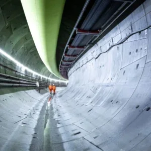
U K press reports claiming that two of London’s newly constructed tunnels are causing the city to sink have been dismissed as creating ‘something out of nothing’ by industry experts.
The claim comes after of a 10 year satellite survey carried out over the capital showed up to 25mm of settlement above London Underground‘s Jubilee Line extension and an electricity tunnel in the city’s south west.
Expert opinion disagrees with the notion of a continually sinking London saying that the settlement was to be expected and poses little threat to long term building stability.
The technology has stirred interest within the tunnelling industry. European satellites pass 500 miles above a given point every 35 days taking a radar image each time. These images are overlaid producing a composite map of ground levels to millimetre accuracy over time. By setting the datum for points that have not moved, it is possible to locate areas that have.
Ren Capes, spokesman for NPA Satellite Mapping, the UK company processing and analysing the radar data told T&TI, "We were quite alarmed at the sensationalist stance taken by the papers, we have just made these measurements, of which we are sure, but as for cause and or effect, that’s outside NPA’s domain of expertise. However we do feel the information is significant and can see many applications. Beside ongoing monitoring, the technique can be useful for the assessment of ground stability before projects even begin."
This could help in the prevention of drawn out settlement claims.


