Indian Railways last month celebrated a breakthrough on the southern section of the 11km long Pir Panjal Tunnel in the foothills of the Himalayas. Some 7.5km of tunnel has been excavated using the NATM technique but the remaining 3.5km will take a further year according to Indian contractor IRCON.
The US$134M tunnel is a crucial part of the 17km long Banihal-Qazigund section of the Jammu-Udhampur-Katra-Quazigund-Baramulla link (JUSBRL) or Kashmir rail link. The 335km railway links the Kashmir Valley with Srinagar, the capital of Jammu and connects into the existing network to provide a direct 900km link to Delhi.
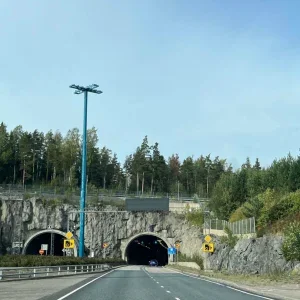
The single-track tunnel cuts through the Pir Panjal range below the snow line and some 450m below the only road tunnel linking Banihal and Qazigund. The tunnel has an average elevation of some 1750m and a maximal overburden of 1100m.
According to Caltrop, which provided construction management service for IRCON, ground conditions through the tunnel length vary greatly. The geology of the Pir Panjal mountain range includes a mixture of very hard and soft to moderately hard rock strata (Cambro-Trias). Hard rock types include andesite/basalt (Panjal Traps), quartzite, silicified limestone and agglomerates while the soft to moderately hard rock types include shale, limestone, agglomeratic shale and tuff.
The portal areas are situated in soft ground made up of fluvio-glacial sediments. It covers both portals for more than 500m. Tunnel excavators were used for the portal areas while roadheaders and drill and blast methods were employed in the main tunnelling works.
The basic tectonic setting of Pir Panjal range in the area of tunnel alignment is dominated by a folding structure leading to different dipping directions on both sides of the range. Contacts between rock units are often faulted. Folding is also common especially in central areas. Bedding of rock is striking sub perpendicular to Pir Panjal tunnel axis.


